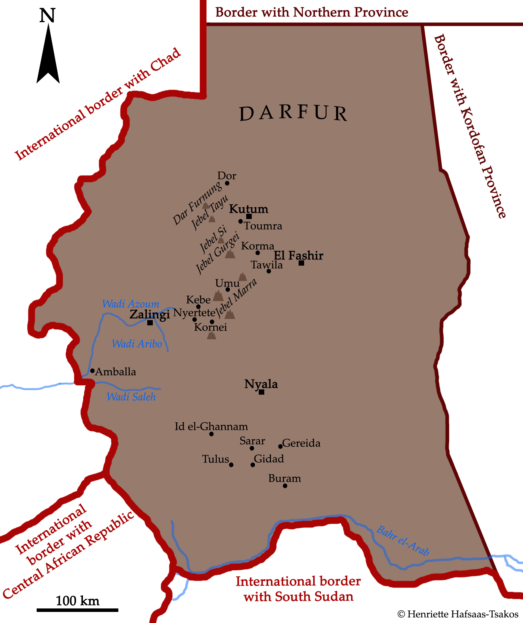
Map of Darfur with modern international borders and provincial borders at the time of the fieldwork presented on this website.
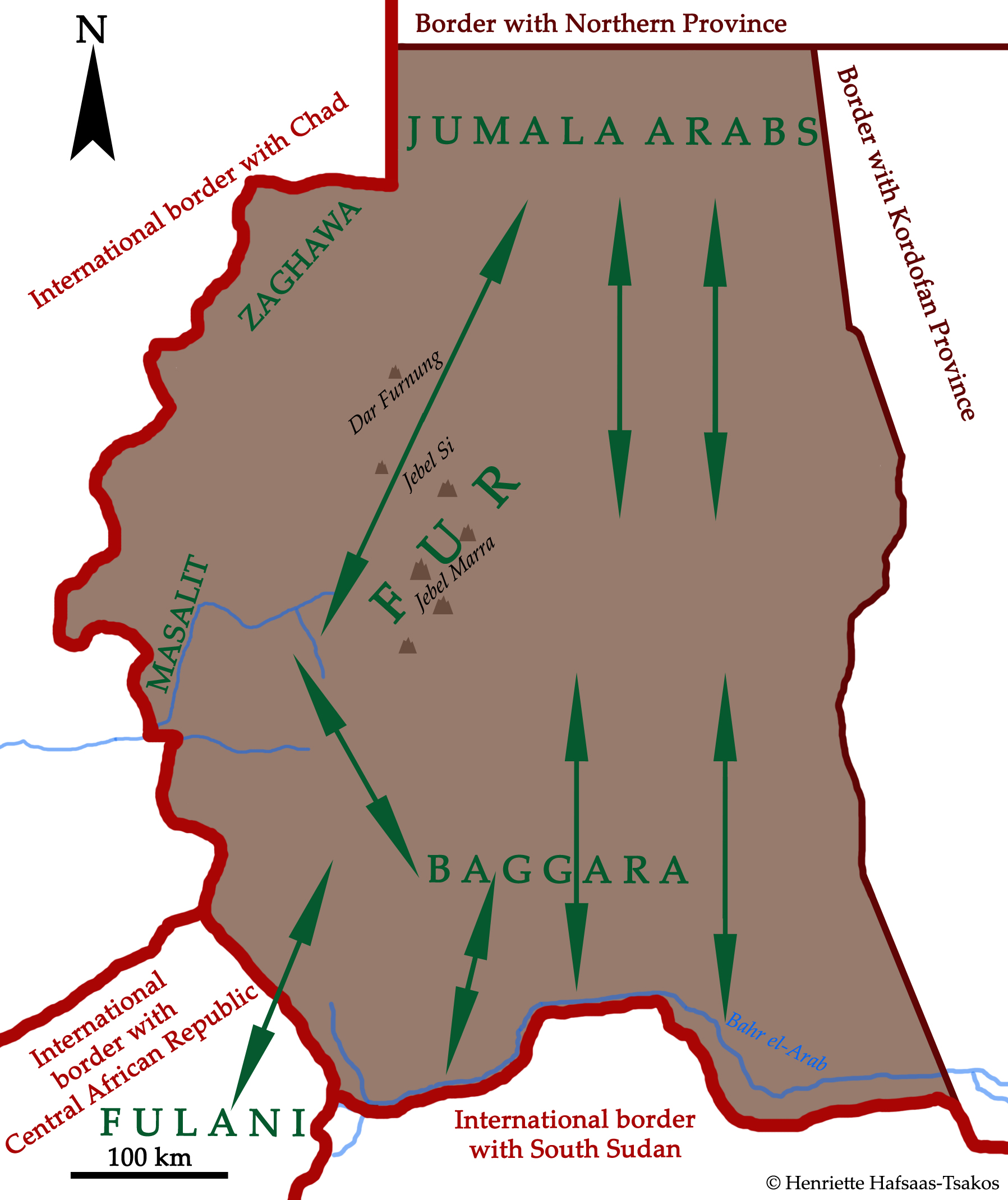
Map of Darfur with migratory routes into Fur area by Baggara Arabs (cattle nomads) from the south, Jumala Arabs (camel nomads) from the north, and Fulani nomads from southwest.
[google-map-v3 width=”510″ height=”600″ zoom=”12″ maptype=”roadmap” mapalign=”left” directionhint=”false” language=”default” poweredby=”false” maptypecontrol=”true” pancontrol=”true” zoomcontrol=”true” scalecontrol=”true” streetviewcontrol=”true” scrollwheelcontrol=”false” draggable=”true” tiltfourtyfive=”false” addmarkermashupbubble=”false” addmarkermashupbubble=”false” kml=”[google-map-v3 width=”500″ height=”600″ zoom=”12″ maptype=”terrain” mapalign=”left” directionhint=”false” language=”default” poweredby=”false” maptypecontrol=”true” pancontrol=”true” zoomcontrol=”true” scalecontrol=”true” streetviewcontrol=”true” scrollwheelcontrol=”false” draggable=”true” tiltfourtyfive=”false” addmarkermashupbubble=”false” addmarkermashupbubble=”false” kml=”https://maps.google.com/?ll=12.479487,27.806396&spn=9.161891,14.27124&t=m&z=7″ bubbleautopan=”true” showbike=”false” showtraffic=”false” showpanoramio=”false”]” bubbleautopan=”true” showbike=”false” showtraffic=”false” showpanoramio=”false”]

